Latest News Archive

Please select Category, Year, and then Month to display items
Previous Archive
12 October 2020 | Story Leonie Bolleurs | Photo Supplied
Adriaan van der Walt
Although several international studies have used temperature metrics to statistically classify their seasonal divisions, a study in which Adriaan van der Walt was involved, would be the first known publication in a South African context using temperature as classification metric.

Gone are the days when we as South Africans would experience a three-month spring season, easing into summer, and then cooling off for three months before we hit winter.

Adriaan van der Walt, Lecturer in the Department of Geography at the University of the Free State (UFS), focuses his research on biometeorology (a specialist discipline exploring the role and climate change in physical and human environments) as well as climatology and geographic information systems.

He recently published an article: ‘Statistical classification of South African seasonal divisions on the basis of daily temperature data’ in the South African Journal of Science.

In this study, which Van der Walt undertook with Jennifer Fitchett, a colleague from the University of the Witwatersrand, data on daily maximum and minimum temperatures was collected from 35 meteorological stations of the South African Weather Service, covering the period between 1980 and 2015.

They went to great lengths to ensure that they had a complete set of data before presenting it to demonstrate seasonal brackets.

First for South Africa

Their statistical seasonal brackets indicate that South Africans now experience longer summers (from October to March), autumn in April and May, winter from June to August, and spring in September.

Although considerable work has been done using rainfall to determine seasonality in Southern Africa, Van der Walt believes that these methods did not work well as there are too many inconsistencies in this approach, as identified by Roffe et al. (2019, South African Geographical Journal). To make matters more complicated – as a semi-arid region, and with desert conditions along the west coast – some regions do not have enough rainfall to use as a classifier.

Temperature, on the other hand, worked well in this study. “Temperature, by contrast, is a continuous variable, and in Southern Africa has sufficient seasonal variation to allow for successful classification,” says Van der Walt.

He continues: “Although several international studies used temperature metrics to statistically classify their seasonal divisions, this study would be the first known publication in a South African context using temperature as classification metric.”

Van der Walt says what we understand as seasons largely relates to phenology – the appearance of blossoms in spring, the colouration and fall of leaves in autumn, and the migration of birds as a few examples. “These phenological shifts are more sensitive to temperature than other climatic variables.”

Seasonal brackets

According to Van der Walt, they believe that a clearly defined and communicated method should be used in defining seasons, rather than just assigning months to seasons.

“One of the most important arguments of our work is that one needs to critically consider breaks in seasons, rather than arbitrarily placing months into seasons, and so we welcome any alternate approaches,” he says.

A number of sectors apply the temperature-based division to their benefit. “For example, in the tourism sector it is becoming increasingly important to align advertising with the season most climatically suitable for tourism,” says Van der Walt.

Temperature-based division is also used to develop adaptive strategies to monitor seasonal changes in temperature under climate change. However, Van der Walt points out that each sector will have its own way of defining seasons. “Seasonal boundaries should nevertheless be clearly communicated with the logic behind them,” he says.

News Archive

Space-based information plays vital role in disaster-risk reduction
2017-02-28

Africa is one of the continents most affected by disasters triggered by natural hazards. The result of climate change is a reality that affects every human being, whether it is extreme heat waves, cyclones, or the devastation of drought and floods. Climate change can provoke injuries or fatalities and affects the livelihoods of people in both rural communities and urban areas. It triggers damage and losses in various sectors of development, such as housing, road infrastructure, agriculture, health, education, telecommunications, energy, and affects routine economic processes leading to economic losses.

According to Dr Dumitru Dorin Prunariu, President of the Association of Space Explorers Europe, space programmes have become an important force defining challenges of the 21st century. “Space observation is essential for climate-change monitoring,” he said.

Dr Prunariu was the keynote speaker at a two-day symposium on climate resilience and water that was hosted by the Disaster Management Training and Education Centre for Africa (DiMTEC), at the University of the Free State (UFS). He participated in the Soviet Union’s Intercosmos programme and completed an eight day-mission on board Soyuz 40 and the Salyut 6 space laboratory, where he and fellow cosmonaut Leonid Popov completed scientific experiments in the fields of astrophysics, space radiation, space technology, space medicine, and biology. He is the 103rd human being to have travelled to outer space.

The focus of Dr Prunariu’s lecture was: Space activities in support of climate change mitigation and climate resilience.
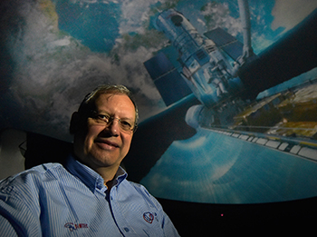
Description: Dr Dumitriu Dorin Prunariu Tags: Dr Dumitriu Dorin Prunariu

Dr Dumitru Dorin Prunariu, the 103rd human
being in outer space and President of
the Association of Space Explorers Europe.
Photo: Charl Devenish

Space-based information, an extra eye that can detect a way out during disasters
“For governments to support communities affected by any disaster, precise and up-to-date information on its impacts is essential as a way to respond in a timely and effective way,” said Dr Prunariu.

Space-based information (derived using Earth observation, global navigation satellite systems, and satellite communications) can play a vital role in supporting disaster-risk reduction, response, and recovery efforts, by providing accurate and timely information to decision-makers.

“With space-based information, disaster management teams will be able to take note of recently established roads that may not appear in typical maps produced by National Geographic Institutes, but which could be used as emergency evacuation routes or as roads to deliver humanitarian assistance to those who require it in remote areas."

Space-based tools help decision-makers to improve planning
“Space-based tools and spatial data infrastructure is also crucial for policy planners and decision-makers in increasing the resilience of human settlements. Using geographic data and information collected before the occurrence of major disasters in combination with post-disaster data could yield important ideas for improved urban planning, especially in disaster-prone areas and highly-populated regions.

“In the recovery process, information on impact is used by governments to provide assistance to those affected, to plan the reconstruction process, and to restore the livelihoods of those affected,” said Dr Prunariu.

“Space observation is
essential for climate-
change monitoring.”

The symposium was attended by representatives from Liberia, Nigeria, Kenya, Ghana, Namibia, and Zimbabwe, with various international scientists from Europe imparting their expert knowledge on water and global resilience. The presence of these international experts strengthened global networks.

It isn't important in which sea or lake you observe a slick of pollution, or in the forests of which country a fire breaks out, or on which continent a hurricane arises, you are standing guard over the whole of our Earth. - Yuri Artyukhin: Soviet Russian cosmonaut and engineer who made a single flight into space.

We use cookies to make interactions with our websites and services easy and meaningful. To better understand how they are used, read more about the UFS cookie policy. By continuing to use this site you are giving us your consent to do this.

Accept