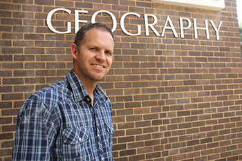
Dr Jay le Roux, one of 31 new NRF-rated
researchers at the University of the Free State,
aims for a higher rating from the NRF.
Photo: Rulanzen Martin
“This rating will motivate me to do more research, to improve outcomes, and to aim for a higher C-rating.” This was the response of Dr Jay le Roux, who was recently graded as an Y2-rated researcher by the National Research Foundation (NRF).
Dr Le Roux, senior lecturer in the Department of Geography at the University of the Free State (UFS), is one of 31 new NRF-rated researchers at the UFS. “This grading will make it possible to focus on more specific research during field research and to come in contact with other experts. Researchers are graded on their potential or contribution in their respective fields,” he said.
Research assess different techniques
His research on water erosion risk in South Africa (SA) is a methodological framework with three hierarchal levels presented. It was done in collaboration with the University of Pretoria (UP), Water Research Commission, Department of Agriculture, Forestry and Fisheries, and recently Rhodes University and the Department of Environmental Affairs. Dr Le Roux was registered for 5 years at UP, while working full-time for the Agricultural Research Council – Institute for Soil, Climate and Water (ARC-ISCW).
Water erosion risk assessment in South Africa: towards a methodological framework, illustrates the most feasible erosion assessment techniques and input datasets that can be used to map water erosion features in SA. It also emphasises the simplicity required for application at a regional scale, with proper incorporation of the most important erosion-causal factors.
The main feature that distinguishes this approach from previous studies is the fact that this study interprets erosion features as individual sediment sources. Modelling the sediment yield contribution from gully erosion (also known as dongas) with emphasis on connectivity and sediment transport, can be considered as an important step towards the assessment of sediment produce at regional scale.
Dams a pivotal element in river networks
Soil is an important, but limited natural resource in SA. Soil erosion not only involves loss of fertile topsoil and reduction of soil productivity, but is also coupled with serious off-site impacts related to increased mobilisation of sediment and delivery to rivers.
The siltation of dams is a big problem in SA, especially dams that are located in eroded catchment areas. Dr Le Roux recently developed a model to assess sediment yield contribution from gully erosion at a large catchment scale. “The Mzimvubu River Catchment is the only large river network in SA on record without a dam.” The flow and sediment yield in the catchment made it possible to estimate dam life expectancies on between 43 and 55 years for future dams in the area.
Future model to assess soil erosion
“I plan to finalise a soil erosion model that will determine the sediment yield of gully erosion on a bigger scale.” It will be useful to determine the lifespan of dams where gully erosion is a big problem. Two of his PhD students are currently working on project proposals to assess soil erosion with the help of remote sensing techniques.