Latest News Archive

Please select Category, Year, and then Month to display items
Previous Archive
06 November 2023 | Story MBALI MABOEA | Photo SUPPLIED
SSAG 2023
The Department of Geography on the UFS Qwaqwa Campus recently played host to the Society of South African Geographers Conference (SSAG 2023), which gathered more than 100 students over three days.

Fostering academic growth, collaboration, and inspiration among students and researchers in the field of geography, the Department of Geography on the UFS Qwaqwa Campus recently played host to the Society of South African Geographers Conference (SSAG 2023), which gathered more than 100 students over three days.

Following a five-year hiatus, the three-day conference comprised student proposal presentations in different fields: human geography, environment geography, geoinformatics, and physical geography, divided into breakaway sessions over two days. Furthermore, day three of the annual conference included an excursion to the Basotho Cultural Village and Clarens. 

The three-day annual student conference focused on different themes presented by two main speakers. The topic of the first keynote speaker, Dr Mahlomola Daemane, General Manager of the SANParks Arid Research Unit, focused on the contemporary conservation, transition, and relevance of science in policy and decision making. 

The second keynote speaker was Dr Felicia Akinyemi, a Marie Sklodowska-Curie Research Fellow affiliated with the Institute of Geography at the University of Bern in Switzerland. Her work focuses on the intersection of geoinformatics, global change, and sustainability. Dr Akinyemi focused her talk on the integrative geospatial methods and metrics for sustainable land use. She introduced different techniques and metrics and gave students insight in early-career African research.

Speaking about the success of the conference, Nthebohiseng Sekhele, Geography Lecturer on the Qwaqwa Campus and chair of the organising committee, said, “The local organising committee was also very impressed with the quality of presentations from our postgraduate students in Geography, as well as the robust discussions that happened during the parallel sessions in the two days of the conference. We had a positive response of physical and online participation from many universities across South Africa. We are pleased that we have achieved our goal with this conference, which is to inspire the next generation of geographers.”

News Archive

Latest information technology employed to make learning in Disaster Management easy
2014-10-20


Prof Dusan Sakulski
Photo: Leonie Bolleurs
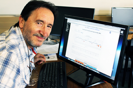
Live, colourful, interactive, real-time-calculated. This is how Prof Dusan Sakulski, researcher and lecturer from the UFS’s Disaster Management Training and Education Centre for Africa (DiMTEC), describes his e-learning platform implemented in this department.

Rather than producing research that gathers dust somewhere in a cabinet, Prof Sakulski believes that research should be used to make life easier, not only for society, but also for his students.
 
This educational civil engineer, who is responsible for information technology implementation in disaster risk management, developed through his research several programs to optimise the three contact sessions DiMTEC students have to attend each year.
 
One of the initiatives implemented by Prof Sakulski and his daughter Teodora, was the recording, editing and compiling of theoretical lessons and making it available to students online. “Students then don’t have the excuse of missing a class. Furthermore, it allows them to rather focus on group work during contact sessions and to discuss problems they encountered with the work,” he says.
 
Students also have access to an early-warning system portal for the prediction of hazards, including droughts, floods, rain and temperature. In the disaster-risk environment, this program is very useful, not only for students, but also for practitioners working with this kind of data on a daily basis. The operational and educational application works in real time – with the click of a mouse students and practitioners have access to information on current weather conditions. Indicators for possible natural disasters are also built into this program. Truly a useful application when you are working in the field of disaster risk management.

Difficult and technical data are presented live, with information that is colourful, interactive, real-time-calculated and audible, thanks to embedded mathematical language. In this way, students can learn, memorise and understand their work better.


We use cookies to make interactions with our websites and services easy and meaningful. To better understand how they are used, read more about the UFS cookie policy. By continuing to use this site you are giving us your consent to do this.

Accept