Latest News Archive

Please select Category, Year, and then Month to display items
Years
2019 2020 2021
Previous Archive
19 March 2019 | Story Dr Cinde Greyling
Dr Mutana and Prof Mukwada
Many people enjoy spending time in the mountainous Drakensberg region. Prof Geofrey Mukwada’s involvement with the UFS Afromontane Research Unit (ARU) sparked an interest in sustainable tourism in the area. Pictured here are Dr Sarudzai Mutana with Prof Mukwada.

Not only is the Qwaqwa Campus situated in a beautiful region – its researchers also contribute to keeping the area pristine. Recent research by Prof Geofrey Mukwada and his PhD student, Dr Sarudzai Mutana, focused on indicators monitoring sustainable tourism development in the Drakensberg region.

Dr Mukwada is an Associate Professor in the Department of Geography on the University of the Free State (UFS) Qwaqwa Campus. 

Our majestic mountains are fragile

Many people enjoy spending time in the mountainous Drakensberg region – either as adventure seekers exploring the many trails, or just relaxing and reconnecting with nature. Prof Mukwada’s involvement with the UFS Afromontane Research Unit (ARU) sparked an interest in sustainable tourism in the area. “Mountains are fragile but attractive environments which continue to attract tourists,” he said. “Tourism is one of the major business sectors in the Drakensberg region, with promising growth opportunities and proving to be an anchor of green economy in the future – if practiced correctly.” Unfortunately, the issue of monitoring sustainable tourism has not been widely researched in African mountains. 

According to international standards

“We specifically looked at the Global Sustainable Tourism Criteria (GSTC), which is an international best-practice framework to help destinations monitor and ensure that tourism is developed in a responsible manner,” Prof Mukwada explained. “South Africa’s Manual for Responsible Tourism was designed according to some of the recommendations of the GSTC. But we found that, while the tourism and hospitality operators in the Drakensberg region appreciates the need to monitor and ensure sustainable tourism in the area, there is limited use of indicators as a tool for monitoring.” 

Forward together

There are competing demands between land-use and development practices and alternatives in the region – unless the focus shifts to sustainable practices, the short-term gains could be followed by dire consequences. “We suggest an integrated monitoring of tourism development, with a pro-poor focus that involves more local community leaders. Going forward, we would like to see the industry adopt the indicators proposed in our study.”

News Archive

Latest information technology employed to make learning in Disaster Management easy
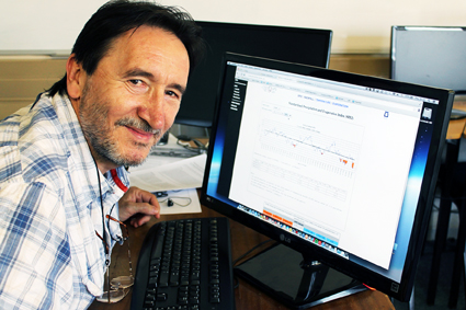
2014-10-20


Prof Dusan Sakulski
Photo: Leonie Bolleurs
Live, colourful, interactive, real-time-calculated. This is how Prof Dusan Sakulski, researcher and lecturer from the UFS’s Disaster Management Training and Education Centre for Africa (DiMTEC), describes his e-learning platform implemented in this department.

Rather than producing research that gathers dust somewhere in a cabinet, Prof Sakulski believes that research should be used to make life easier, not only for society, but also for his students.
 
This educational civil engineer, who is responsible for information technology implementation in disaster risk management, developed through his research several programs to optimise the three contact sessions DiMTEC students have to attend each year.
 
One of the initiatives implemented by Prof Sakulski and his daughter Teodora, was the recording, editing and compiling of theoretical lessons and making it available to students online. “Students then don’t have the excuse of missing a class. Furthermore, it allows them to rather focus on group work during contact sessions and to discuss problems they encountered with the work,” he says.
 
Students also have access to an early-warning system portal for the prediction of hazards, including droughts, floods, rain and temperature. In the disaster-risk environment, this program is very useful, not only for students, but also for practitioners working with this kind of data on a daily basis. The operational and educational application works in real time – with the click of a mouse students and practitioners have access to information on current weather conditions. Indicators for possible natural disasters are also built into this program. Truly a useful application when you are working in the field of disaster risk management.

Difficult and technical data are presented live, with information that is colourful, interactive, real-time-calculated and audible, thanks to embedded mathematical language. In this way, students can learn, memorise and understand their work better.


We use cookies to make interactions with our websites and services easy and meaningful. To better understand how they are used, read more about the UFS cookie policy. By continuing to use this site you are giving us your consent to do this.

Accept